Maui, pronounced /ˈmaʊi/ in English and [ˈmɐwwi] in Hawaiian, constitutes the second-largest landmass among Hawaii’s islands, covering an area of 727.2 square miles (1,883 km2), and ranks as the 17th largest island in the entire United States.
It holds the distinction of being the largest island in Maui County, which also encompasses Molokaʻi, Lānaʻi, and the uninhabited Kahoʻolawe. The island’s population in 2020 reached 168,307 residents, marking the third highest among the Hawaiian Islands, following Oʻahu and Hawaiʻi Island. Kahului, with a population of 28,219 as of 2020, represents the island’s largest census-designated place (CDP) and serves as its commercial and financial center.
Meanwhile, Wailuku serves as the seat of Maui County and stands as the third-largest CDP as of 2010. Notable locations include Kīhei, which includes Wailea and Makena in the Kihei Town CDP, the island’s second most populous CDP; Lāhainā, home to Kāʻanapali and Kapalua within the Lāhainā Town CDP; as well as Makawao, Pukalani, Pāʻia, Kula, Haʻikū, and Hāna.
Geological Structure and Terrain
The intricate landscapes of Maui are the outcome of a distinctive interplay between geology, terrain, and climate. Each volcanic peak in the series of Hawaiian Islands is constructed from basalt, a dark, iron-rich rock with low silica content, which flowed out from numerous vents as incredibly fluid lava across countless millennia. Some of these volcanoes were positioned so closely that the lava streams on their sides merged, fusing into a singular landmass. Maui exemplifies such a “volcanic doublet,” originating from the overlapping of two shield volcanoes that formed an isthmus between them.
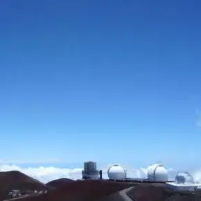
The more ancient, western volcano has endured substantial erosion and is intersected by multiple watercourses, giving rise to the summits of the West Maui Mountains (known in Hawaiian as Mauna Kahalawai). Among these peaks, Puʻu Kukui rises the highest at 5,788 ft (1,764 m). In contrast, the larger, younger volcano situated to the east, Haleakalā, reaches an elevation of 10,023 ft (3,055 m) above sea level and spans a distance of 5 mi (8.0 km) from its base on the seafloor to its summit.
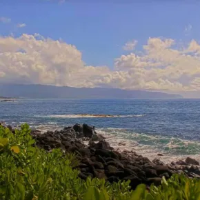
The eastern slopes of both volcanoes exhibit deeply carved valleys and steep-walled gullies that slope downward to the rocky and windswept coastline. The valley-like Isthmus of Maui, which separates the two volcanic masses, was shaped through the deposition of sandy erosion remnants.
The most recent eruption on Maui (originating from Haleakalā’s Southwest Rift Zone) probably occurred between 1480 and 1600; the resulting streams of molten rock can be found at Cape Kīnaʻu, situated between ʻĀhihi Bay and La Perouse Bay along the southwestern shoreline of East Maui. Although regarded as dormant by geologists, Haleakalā is considered to have the potential for future eruptions.
Maui is an integral part of a broader formation, known as Maui Nui, which encompasses the islands of Lānaʻi, Kahoʻolawe, Molokaʻi, and the now-submerged Penguin Bank. During periods of lowered sea levels, including as recently as 200,000 years ago, these landmasses were interconnected as a singular island due to the shallow channels separating them.