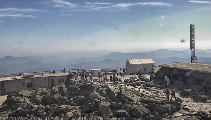
Mount Washington, situated in New Hampshire, proudly holds the title of the highest peak in the Northeastern United States, soaring to an elevation of 1,916.6 meters. Additionally, it stands as the most topographically prominent mountain east of the Mississippi River.
The mountain has gained notoriety for its highly unpredictable and varied weather patterns. A notable instance occurred on April 12, 1934, when the Mount Washington Observatory recorded a staggering windspeed of 372 km/h at the summit, establishing a world record that endured from 1934 until 1996.
Mount Washington retains its distinction for the highest measured wind speed that isn’t linked to a tornado or tropical cyclone.
Found in the Presidential Range of the White Mountains, within Coös County, New Hampshire, Mount Washington extends across several unincorporated townships. The summit specifically falls within the jurisdiction of Sargent’s Purchase. While a significant portion of the mountain is encompassed by the White Mountain National Forest, an area spanning 24.4 hectares around the summit, inclusive of the summit itself, is embraced by Mount Washington State Park.
Two primary routes lead to the summit: the Mount Washington Cog Railway, ascending the western slope, and the Mount Washington Auto Road, ascending from the east. The mountain attracts numerous hikers, and the illustrious Appalachian Trail traverses its summit.
Beyond hiking, other popular activities encompass glider flying, backcountry skiing, and annual cycling and running races like the Auto Road Bicycle Hillclimb and Road Race.