This live stream offers 24/7 real-time earthquake monitoring, providing viewers with immediate data on seismic activity worldwide. The system operates continuously, detecting and analyzing earthquakes as they occur, using a network of global seismic sensors.
The platform automatically locates the epicenter of each earthquake, estimates its magnitude, and calculates the depth at which it occurred. This data is critical not only for researchers and emergency response teams but also for anyone interested in monitoring geophysical events as they unfold. By combining raw seismic data with location services, the system presents accurate and timely updates that reflect the current state of tectonic activity across the globe.
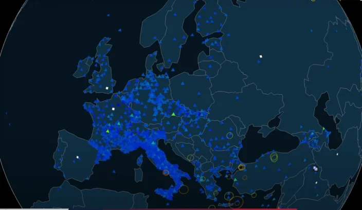
Earthquakes are detected using an array of high-sensitivity seismographs, often positioned near fault zones and tectonic plate boundaries. When seismic waves are recorded, the system rapidly processes the data, triangulates the location, and updates the global feed in real time. The most recent events appear on-screen with key details including magnitude (on the Richter or moment magnitude scale), depth in kilometers, and geographical coordinates.
Live webcam feed serves both as an educational tool and a real-time dashboard for tracking earthquakes. The stream is particularly useful for monitoring aftershocks, volcanic activity, or tsunami risks that can follow significant seismic events. Visual alerts often indicate recent earthquakes on an interactive map, with time stamps and live data.